blog
Geospatial Analysis for Assessing Crop Health Risks Due to Climate Change
Geospatial Analysis for Assessing Crop Health Risks Due to Climate Change
Sustainable living for everyone on Earth demands an in-depth knowledge of threats that threaten the food chain. Climate change poses particular risks to crops, making them susceptible to pests, diseases and temperature-related challenges. Recognising this urgency, Trade in Space’s analyst team led an innovative project sponsored by Scottish Enterprise in order to assess crop health using advanced data layers and assess risk.
As part of its goal to evaluate the effect of changing weather and climate patterns, this project harnessed geospatial analysis. Accessing comprehensive climate data for agricultural commodities holds immense promise in protecting future supply chains.
This project used various data layers and geospatial analysis techniques to comprehensively assess the impact of changing weather and climate patterns on crop health, providing better access to climate data for agricultural commodities and enabling informed decision-making as well as increasing supply chain security.
Trade in Space partnered with Vanguard Economics to analyse aflatoxin risk in maize and corn cultivated in Rwanda. Utilising open-source satellite data and advanced risk modeling techniques to develop a proprietary crop health risk score. The assessment considered factors such as humidity, land temperature, and soil moisture Furthermore, this project also provided supply chain evaluation as well as sustainability considerations using ecological data to pinpoint areas most prone to aflatoxins.
The analysis utilised multiple data layers, each offering insight into crop health risks. Soil moisture data served as an indicator of irrigation needs, providing assessment of available water for crops; surface temperature provided a general indicator of atmospheric temperatures and evaporation potential, while relative humidity provided information about atmospheric moisture content. When aggregated together, these layers provided a comprehensive risk score per-pixel or regionally, giving stakeholders access to actionable insights.
Users are able to track changes in risk over time, adapting to shifting environmental and weather patterns. Farmers within the monitored area were then assigned risk scores based on the likelihood of aflatoxin growth.
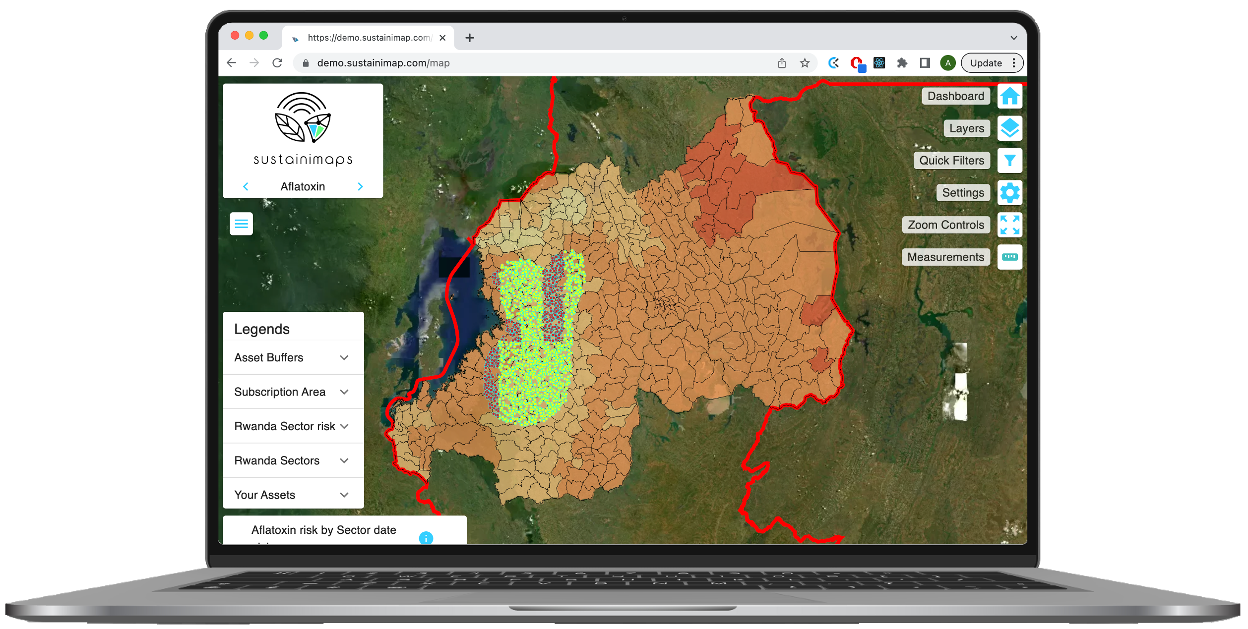
The team went further by visualising risk assessment data into easily understandable visuals, using risk heat-maps created using their existing platform Sustainimaps. These heat-maps represented risk of aflatoxin outbreaks for each municipality over the previous four quarters; users could monitor and assess these evolving risk levels against changing environmental conditions and weather patterns, and farm within monitored areas were assigned risk scores to provide clarity of likelihood of aflatoxin growth.
Notably, the project revealed that the parameters used to evaluate aflatoxin risk could also be applied to measure other crop health indicators in sectors other than maize. With this realisation in mind, the development team expanded their data layer to incorporate a wider crop-health indicator that allowed users to access a heatmap indicator highlighting environmental stressors and susceptibilities to diseases; providing users with valuable data which allows for proactive crop monitoring and management while supporting sustainability efforts as well as driving improved decision making processes.
Environment Systems was also conducting a partner project that examined the effects of climate change on coffee production regions in Colombia. By monitoring data parameters that indicate suitability for coffee growing, an extensive climate risk analysis was carried out which provided valuable insight into what levels of risk farms faced due to changes in their climate-driven environments.
Trade in Space’s team is actively conducting analysis and research using remote sensing and distributed ledger technologies to support food supply chain sustainability while creating frictionless trade. For more information about this study or any of their products offered by Trade in Space, feel free to reach out to hello@tradeinspace.com